create_a_project
For HiRISE stereo processing, create a project in Geographic Coordinates, using Mars2000 as the datum. (Note that SOCET SET also allows a project in a map projection. This would generally be needed only if the project is (a) polar and (b) spans a large range of latitudes.)
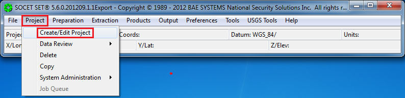
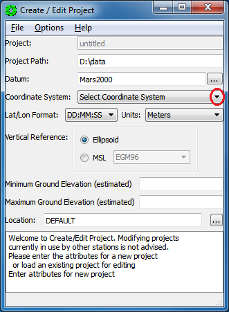
From the SOCET SET menu bar, select “Project” > “Create/Edit Project”.
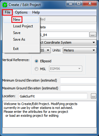
Select “File” > “New”
-
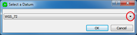
Press the box next to the datum field to bring up the
“Select a Datum”window.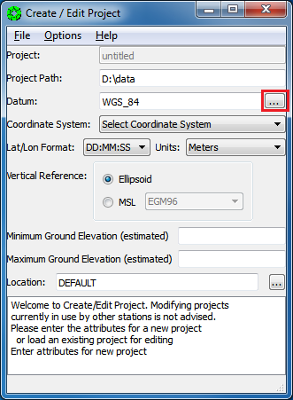
-
Right-Click on the down arrow in the selection window to display drop-down box of options.
-
Scroll about 90% down the list, or press the letter M to skip down the list to the datums starting with the letter M. Select
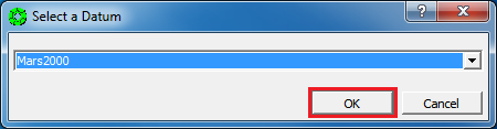
Mars2000and then pressOK.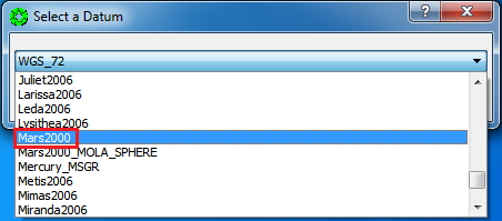
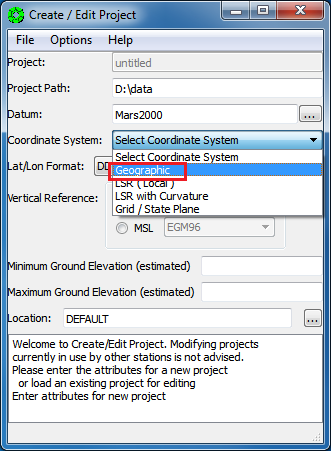
For SOCET SET projects in Geographic Coordinates, you must enter a reference latitude and longitude coordinate (this is equivalent to the center longitude and center latitude of the equi-rectangular map projection.)
The reference latitude and longitude coordinates can be found in the SOCET SET project statistics file, generated by hidata4socet.pl.
-
Use a text editor to open
<ProjectName>_SS_statistics.lis. For columnGuest Facility Users, this file is located inZ:\\<ProjectName>and named<ProjectName>_SS_statistics.lis.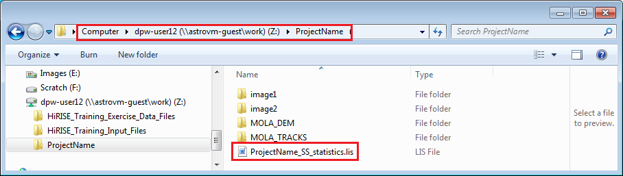
-
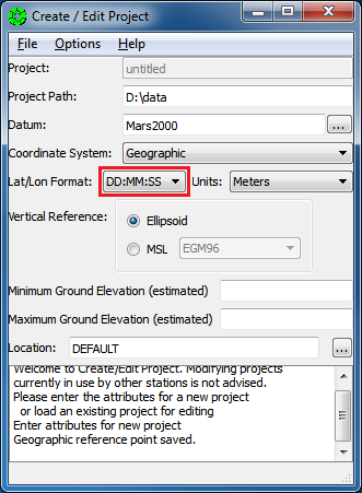
On the Create/Edit Project window, Left-Click on the down arrow next to Coordinate System name to display drop-down box of options and select Geographic.
-
You will be prompted to enter a reference point within the project in Degrees Minutes Seconds (DMS) format. Enter the coordinate listed in
<ProjectName>_SS_statistics.lisfile generated byhidata4socet.pl. Then pressOK.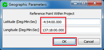
-
Do not close
<ProjectName>_SS_statistics.lisyet. It is needed again, below. -
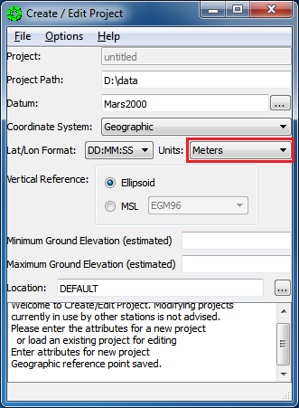
Keep the default Lat/Lon Format definition: DD:MM:SS
Note: We’ve tried using a lat/lon format of decimal degrees, but found in some cases the lat/lon format is in DMS regardless. So we are sticking with DMS throughout SOCET SET processing.
-
Keep the default Units definition: Meters
-
Press the
Ellipsoidradio button (this should be the default).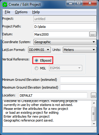
-
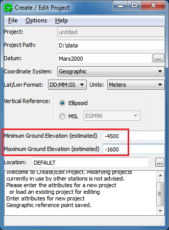
For the Min and Max Ground Elevations, enter the minimum and maximum elevations listed in the project statistics file generated by
hidata4socet.pl <ProjectName>_SS_statistics.lis.Note: A rough estimate of the expected elevation range over the project area is all that is needed.
-
Now close
<ProjectName>_SS_statistics.lis.
-
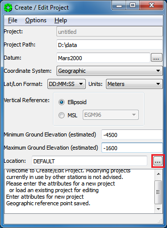
Press the box next to the Location field to bring up a selection window.
-
Press
Edit Locationsto add a directory/folder to the File Location list.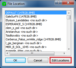
-
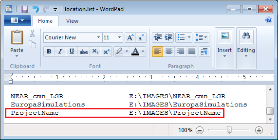
The WordPad editor will be initiated. Scroll to the bottom of the file. Enter your desired location/folder name following the format of the location.list file, then save and exit from WordPad.
Note: (1) Do not use tab in editing the File locations information as it will lead to errors in intrepretation by SOCET SET. (2) We scroll to the bottom of the list because the top three lines define a default images folder, and the default should not be changed.
-
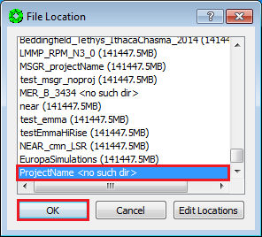
From the File Location window (it remained open while editing the location.list file), you can now scroll to the bottom of the list and select your location/folder for the project to store and create images in.
Note: If your folder name is not listed, press
Canceland reopen the file (by pressing the box next to Location field) to see your folder name.Note: Upon data entry the window may report that there is “no such directory”, it is safe to ignore this prompt and continue. (The directory will be created for you once project creation is complete.)
-
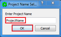
Select
File > Save As.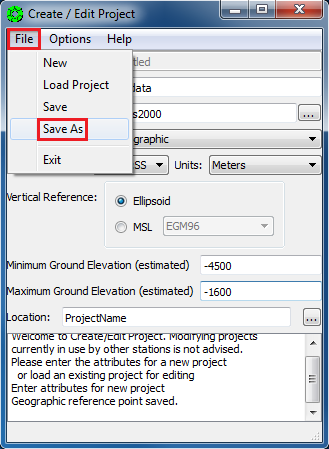
-
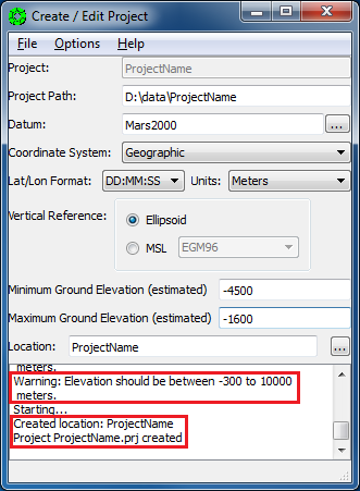
Enter the name of the project in the pop-up window, then press “OK”.
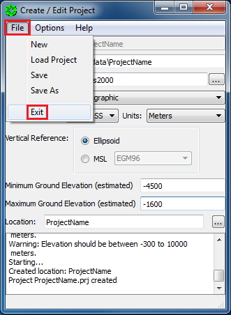
If the images folder did not previously exist (set in the previous section), SOCET SET will now create it, along with the data folder. For an elevation range below -300 meters, or greater than 10000 meters, you will get a warning message. This warning can be ignored for non-Earth projects.
-
Select
File > Exit.