Geo Activity Playground is a software to view recorded outdoor activities and derive various insights from your data collection. All data is kept on your machine, hence it is suitable for people who have an affinity for data analysis and privacy.
It caters to serve a similar purpose as other systems like Strava, Statshunters or VeloViewer, though the focus here is on self-hosting and using local files.
One can use this program with a local collection of activity files (GPX, FIT, TCX, KML, CSV) or via the Strava API. The latter is appealing to people who want to keep their data with Strava primarily. In case that one wants to move, this might provide a noncommittal way of testing out this project.
The main user interface is web-based, you can run this on your Linux, Mac or Windows laptop. If you want, it can also run on a home server or your personal cloud instance.
Please see the hosted documentation for more details, setup instructions and a general tour of the available features.
-
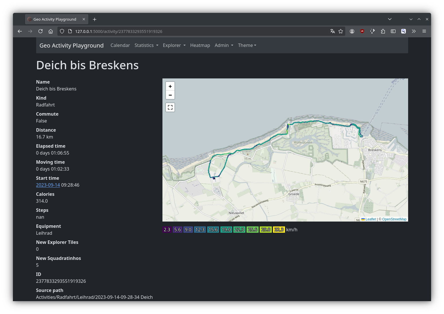
📍 Activity Import & Analysis
Use your GPX, FIT, TCX, KML, or CSV files. View detailed stats like distance, elevation and more. -
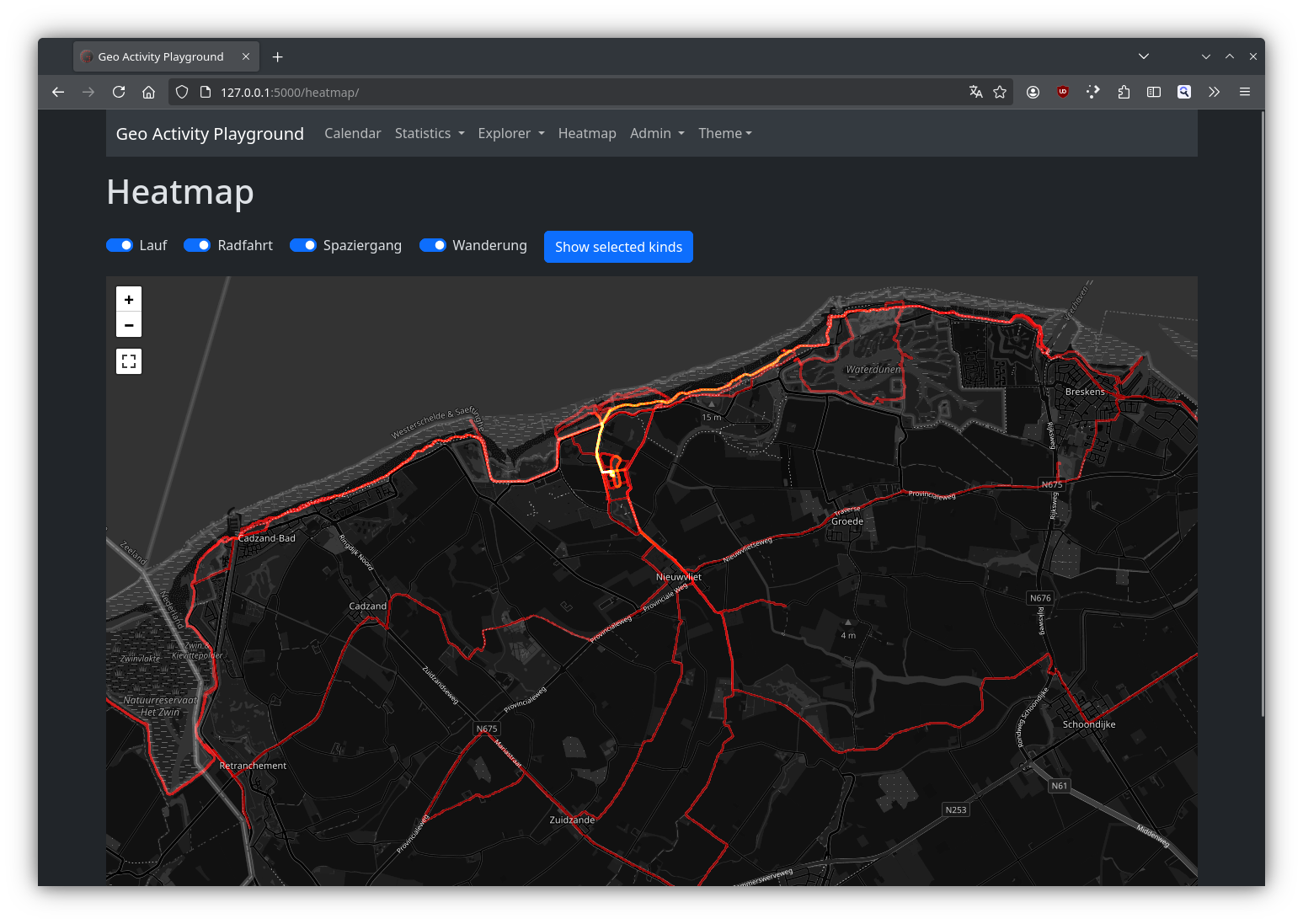
🗺️ Interactive Maps & Heatmaps
Visualize routes on a map, create heatmaps of your most frequent paths, and spot your favorite spots or missed areas. -
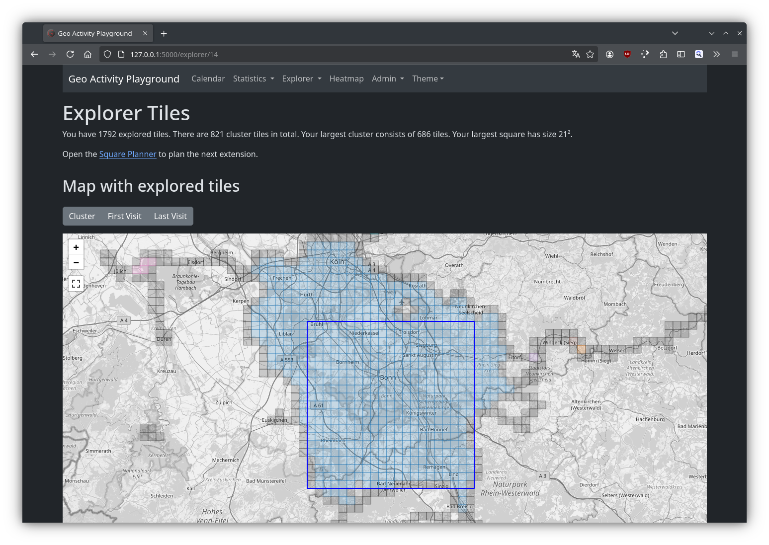
🧩 Explorer Tiles
Break the world into tiles and see which ones you’ve visited — great for motivation and adventure planning! -
🛡️ Privacy Zones
Hide or blur sensitive areas like your home or workplace. Your data stays private and local. -
🔁 Strava API Integration (Optional)
Import activities directly from your Strava account with a single click. No data is uploaded — it’s all stored locally.
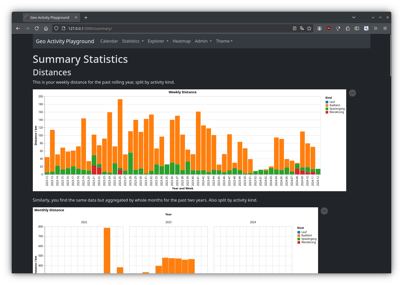
Here are a few examples of what Geo Activity Playground looks like in action:
The app runs on Linux, macOS, and Windows. No cloud service required — it's just Python and a browser!
For full setup instructions and OS-specific steps, visit the documentation.